Utah National Parks: Trees & Rocks

The Weekly Photo Challenge this week is Structure. I immediately thought of our recent trip to the five national parks in Utah. The structure of the rocks and geological features is complimented by the trees in these parks. Whether dead and twisting, or green and contrasting, the trees are a main character in an interesting landscape.

Arches National Park, Utah 3May2017

Arches National Park, Utah

The arches are amazing at Arches National Park and standing dead trees add to the scene. You can see Double Arch in the background.

A fence along the trail in Canyonlands National Park, Utah 4May2017

A fence along the trail in Canyonlands National Park, Utah

I loved these fences made from old juniper wood in Canyonlands National Park. They helped keep people on the trail and were nice to look at too.

Capitol Reef National Park, Utah 5May2017

Capitol Reef National Park, Utah

The rainbow of colors in the cliffs of this canyon in Capitol Reef National Park were complimented by the bright green of the trees. A storm was moving in in this picture.

Bryce Canyon National Park, Utah 6May2017

Bryce Canyon National Park, Utah

A windswept pine tree clings to the edge of a cliff in Bryce Canyon National Park. Puffy white clouds (like in “The Simpsons” cartoons) float gracefully in the background.

Zion National Park 6May2017

Zion National Park

Colorful and tilting structures in the rock, line a tree-filled canyon in Zion National Park. A few wispy clouds hang over the valley.

The national parks in Utah are full of interesting structures both large and small. The geology of the region tells a dramatic story. The trees and other plants living here have adapted to harsh conditions. The wildlife living here takes advantage of the local environment.

Take the time to look up but also to look down when you visit these parks. Each park is a little different from the others and each one has amazing sights worth seeing. The forces of Nature are strong here.

Art in The High Desert show 2017

Artwork shines at the Art in the High Desert show

If you’re looking for things to do in Bend this weekend, go see the Art in the High Desert show. This juried arts and crafts show features works in a wide variety of media. Please help support the 115 North American artisans selected for this show by purchasing some of the things they have created. To see a gallery of the work featured this year, click here.

Woodwork by Jack West at Art in the High Desert 2017 Bend, Oregon

Woodwork by Jack West at  Art in the High Desert 2017 in Bend, Oregon

Here is the woodwork of Jack West of Fort Jones, California. These works of art display fine craftsmanship and an eye for bringing out the best in the woods he works with. The carved curving lines on some of his works are unique and they enhance the wood’s natural beauty. You can see more of his work here .

Ceramics by Gerard Arrington at Art in the High Desert Bend, Oregon

Ceramics by Gerard Arrington at Art in the High Desert 2017 in Bend, Oregon

Here is the ceramic work of Gerald Arrington of Sebastopol, California. You may know that I have a thing about rocks and this artist creates realistic-looking rocks out of clay. His pieces are sculptural, stunning, and earthy. You can see more of his work here.

Sunny views of the show

Crossing the bridge over the Deschutes River to see the Art in the High Desert show Bend, Oregon 26Aug2017

Crossing the bridge over the Deschutes River to see the Art in the High Desert show in Bend, Oregon

This show is good every year but this year it’s great! If you go to the show, you will understand why it’s in the top ten shows in the nation.  The show runs August 25-27 and it’s free to get in. It’s located on the banks of the Deschutes River in Bend at 730 SW Columbia Street.


Solar Eclipse Success!

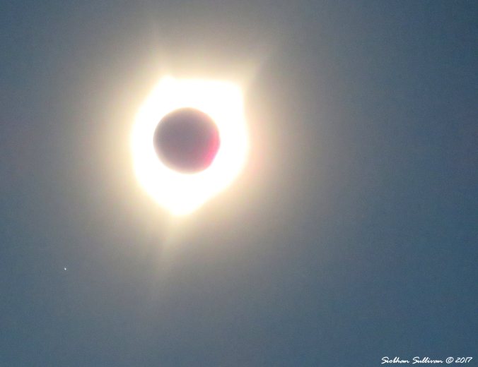
We traveled half an hour from our house to see the eclipse in the Path of Totality. Success!

Eclipse 2017 Prineville, Oregon 21August2017

Here’s some pictures I took right before the moon covers the sun.

Eclipse 2017 Prineville, Oregon 21August2017Eclipse5 21Aug2017Eclipse6 21Aug2017Eclipse7 21Aug2017

My partial pictures are not quite as good because I was trying to figure out the best place for the filter.

We viewed the eclipse from Ochoco Wayside State Park, just west of Prineville, Oregon. The road up to the park was closed when we arrived there at 6:30 am so we hiked about 1/2 mile up the hill to meet more of our group who had arrived there earlier. Smoke from wildfires gave us an interesting sunrise from the 3,048 foot peak.

Sunrise Eclipse 2017 Prineville, Oregon 21August2017

Continue reading →

Bright Passes

Cloudy pass near Great Basin National Park, Nevada 8May2017

Storms can be raging around you
Clouding your judgement
Darkening your mood
Look for the passes
On your horizons
Make your way
Across the low spots to the
Brightness beyond the barriers


Weekly Photo Challenge – Elemental

It is Balloon!

If you’re looking for things to do in Bend this weekend, it’s  time once again for the Balloons Over Bend event. Here are a few shots I took at 6:45 this morning. See more pictures and info about the event at my post from last year –  Hot Air Extraordinaire.

Continue reading →

Castles of Bryce

Being a visual person, I have always wanted to visit Bryce Canyon National Park. I was not disappointed when I visited the park in May. Here are some of the many multi-layered delicate castles of stone in the park. They are a visual treat to all that are lucky enough to see them.

Bryce Canyon National Park 6May2017

Weekly Photo Challenge – Satisfaction

Friday Flowers & Flag Bridge

Just couldn’t resist posting one more picture of a bridge.  The color of the flags on the bridge are changed with the various seasons, holidays, and events.  This bridge is not far from the one I posted on Wednesday.  The bridge is in Bend, Oregon and it goes over the Deschutes River.  There are some nice trails to walk on near the river.  It’s also fun to inner tube, kayak, and stand up paddle board here. Colorful flowers around the area are in full bloom.

Bridge at Old Mill, Bend, Oregon 7July2017Flowers and bridge in the Old Mill district, Bend, Oregon 7July2017

Weekly Photo Challenge – Bridge

Visiting Westworld

In search of Westworld

Do you enjoy watching the HBO series Westworld? When I first watched the show, I wondered where some of the stunning outdoor shots had been filmed. Interesting land features and sunny skies serve as a backdrop in this series. I found out that several filming locations were in Utah so we visited them on a recent trip.

Westworld, Dead Horse Point State Park, Utah 3May2017
Dead Horse Point State Park, Utah

Origins of Westworld

This series is based on the 1973 Westworld movie, written and directed by Michael Crichton. In this sci-fi classic, wealthy tourists visit an Old West-themed amusement park where they can indulge in any of their fantasies with no consequences. The “hosts” in the park appear to be human but they are actually androids. Though the skies appear to always be sunny, there are dark plot twists involving the hosts in both the movie and the series.

Castle Valley near Moab, Utah 4May2017
Castle Valley near Moab, Utah

Jonathan Nolan and Lisa Joy worked on the screenplay for the new series. It debuted on HBO in October of 2016. You may have heard of Jonathan’s brother, Christopher Nolan. The two of them co-wrote the screenplays for The Dark Knight, The Dark Knight Rises, and several other successful films. Jonathan worked as a writer, director, and executive producer on the Westworld series, roles he also held for the Person of Interest series.

Continue reading →

A story in layers

Land forms of the Moenkopi Formation at Capitol Reef National Park, Utah 5May2017

Land forms of the Moenkopi Formation at Capitol Reef National Park, Utah

Land forms at Capitol Reef National Park

The landscape at Capitol Reef National Park tells many stories in colorful layers of rock. The darker columns in the picture above are part of the Moenkopi Formation and it is 225 million years old.

The sedimentary layers of rock in this picture consist of silt, sand, clay, and gravel. The bands of gray and burgundy are made up of volcanic ash. The 700 foot thick layer at the base of the cliffs is the Chinle Formation. That formation contains a lot of petrified wood.

I was impressed by contrasting colors and textures at this park. If you take a trip to Utah, don’t overlook this park. There are a lot of hiking trails here and a short scenic drive.

Weekly Photo Challenge – Order

Fleeting moments with a friend

Kayaking at Hosmer Lake, Oregon

A friend may well be reckoned the masterpiece of nature.
Ralph Waldo Emerson

Remembering a wonderful trip with my friend at Hosmer Lake.

Weekly Photo Challenge – Friend

Wear in the world?

Can you guess where (or wear) I was earlier this month? Yes! I was on a 2,754-mile road trip to see parks in Utah and Nevada. We visited five national parks and one state park in Utah and one national park in Nevada.

I love the artwork on these t-shirts. It’s nice to remember a place with a piece of art you can wear.

BryceNatPk 6May2017

I took a few pictures while on this trip. 1,420 to be exact. Lots of material for future blog posts!

Newspaper Rock – Ancient Messages in Stone

Newspaper Rock, UT 4May2017An amazing example of petroglyphs can be seen on the road into the Needles section of Canyonlands National Park in Utah. Wow! I have seen petroglyphs before but never so many in one spot. There are more than 650 drawings on Newspaper Rock at this state historical monument. The dark desert varnish provides a nice contrast to the messages carved into the stone.

Newspaper Rock 2, UT 4May2017The first carvings at this site have been determined to be 2,000 years old. People of the Archaic, Anasazi, Fremont, Navajo, Anglo, and Pueblo cultures have carved their messages into the rock over the years. Unfortunately, it looks like some more modern graffiti artists added to parts of the scene.

Newspaper Rock 3, UT 4May2017The meanings of the messages here have been difficult to figure out. Do they tell a story or are they merely scribbles? The Navajo refer to Newspaper Rock as Tse’ Hane – translated as  “Rock that tells a story.” It does indeed appear to tell many stories. Only the people who made the carvings know exactly what those stories were.

Weekly Photo Challenge – Heritage
Continue reading →

Tumalo Dam Hike

TumaloReservoirHike12 10Apr2017

Bull Flat from Tumalo dam

A brief history

It’s hard to imagine that the big flat area pictured above was once filled with water that all disappeared. Developer William A. Laidlaw was in this area in the early 1900’s and he promised settlers a project that would irrigate nearly 30,000 acres. Local businesses and settlers put up some of their hard earned dollars for the project but then figured out they were being taken advantage of. Laidlaw was burned in effigy in 1907 and 1912. New plans were made by the state for a reservoir.

Construction of the dam ca. 1914

Tumalo Dam construction.  Photographic copy of TID photograph (from original print on file at TID office, Tumalo, Oregon).

In 1914, the huge earthen Tumalo Dam on the edge of 1,100 acre Bull Flat was constructed. It took 18 months to complete. The reservoir was filled with thousands of gallons of water. A couple of school kids were passing by the reservoir one day and heard a roaring noise like a tub draining. A giant whirlpool was sucking down the water at the rate of 220 cfs – as fast as it was being filled. Yikes!

They tried plugging the hole with bales of hay and detonating dynamite on floating barges. Nothing worked. It turned out the engineer that designed the project had not done much work on the soil at the site. It is extremely porous and modern day engineers liken it to a sponge. There are also lava tubes underneath the surface.  Continue reading →

The wonder of Sahalie Falls

Sahalie Falls, Oregon 30Aug2016

Sahalie Falls, Oregon

“The key to a wonderful life is to never stop wandering into wonder.”

Suzy Kassem

Weekly Photo Challenge – Wanderlust

Lava Rock Red

Lava rock red. The view from Lava Butte 4Sept2014

The soil in central Oregon likes to remind you of its origins by shouting it out to you in deep shades of red. Lava rock red. Here is the view from Lava Butte, south of Bend. For more on visiting that area, see my post here.

Weekly Photo Challenge – Earth

Peter Skene Ogden Viewpoint

Crooked River Railroad Bridge 3Apr2017

Crooked River Railroad Bridge

You might drive right past the Peter Skene Ogden Viewpoint but stop and check it out. Driving along U.S. Route 97 north of Redmond, Oregon, a bridge dramatically spanning a deep canyon grabs your attention. The Crooked River Railroad Bridge was built in 1911. It passes over the Crooked River, 320 feet below.

There is a nice rest area here with picnic tables, restrooms, and scenic viewpoints. You can get a bird’s eye views of birds of prey, swallows, and other cliff dwellers from here. We had a bald eagle glide over our heads while a turkey vulture drifted by nearby.

The Crooked River, true to its name, meanders in a twisting course through the canyon below the bridge. You get great views of the lichen covered cliffs from this viewpoint. This area was formed about 350,000 years ago as lava flows from the Newberry Volcano, 40 miles to the south, moved northwards.

This viewpoint is named after Peter Skene Ogden, who first entered central Oregon in 1825 when working as a trapper for the Hudson’s Bay Company. For more about the park, click here.

Crooked River at Peter Skene Ogden Scenic Viewpoint 3Apr2017

Crooked River

Continue reading →

An artist’s wish

Grand Prismatic Spring, Yellowstone National Park 5June2015

Grand Prismatic Spring, Yellowstone National Park

Sometimes an artist’s greatest wish is that others will be able to see the emotion and spirit of a place in their work. I hope you can feel some of what I was trying to capture in this photo from Yellowstone National Park.

Art is about expressing the true nature of the human spirit in whatever way one wishes to express it. If it is honest, it is beautiful. If it is not honest, it is obvious.
Corin Nemec

Weekly Photo Challenge – Wish

Looking back to Fort Rock

View of Fort Rock, Oregon 10June2016A sky streaked with clouds frames Fort Rock, rising from the sagebrush sea in central Oregon. This is the view from a cave where ancient sandals made from sagebrush were found. Sandals and other artifacts found there were determined to be 9,300-10,250 years old. Walking from the cave back towards the mountain, you can almost imagine some of the sights ancient people may have seen.

For more about the cave, visit my post. Read more about the excellent  Fort Rock Valley Historical Society Homestead Village Museum, on another one of my posts.

Weekly Photo Challenge – The road taken

A Matched Pair

Draft horse outdoor metal sculpture  in Bend, Oregon 4Dec2016Here is another great outdoor metal sculpture by local artist Greg Congleton. This sculpture depicts a team of draft horses pulling a log. Thousands of draft horses were imported from Western Europe in the late 19th and early 20th century to help with logging, farming, and moving freight and passengers.

Sign for Two Bits outdoor metal sculpture, Bend, Oregon 4Dec2016Here is the sign nearby that lists some of the parts used to make this sculpture. Can you find any of them?

Note that this sculpture was donated by Penny and Phil Knight. Phil is the co-founder and chairman emeritus of a company named Nike. Perhaps you have heard of it.

Here is a video of Belgian draft horses at work dragging logs. They are pretty impressive.


Weekly Photo Challenge – A Good Match

Snowshoeing at Swampy Lakes

Swampy Lakes Short Snowshoe trail, Bend, Oregon 14Feb2017If you want to go snowshoeing close to Bend, check out the trail at Swampy Lakes Sno-Park. It’s a short ways away from the more popular Virginia Meissner Sno-Park and is tucked in the shadow of Mount Bachelor. There are plenty of parking spaces but make sure you purchase a Sno-Park Parking Permit before you go.

Both Virginia Meissner and Swampy Lakes Sno-Parks offer trails for snowshoeing, cross-country skiing, and fatbiking. Some of the other sno-parks in the area also have places for snowmobiling.

Swampy Lakes Short Snowshoe trail, Bend, Oregon 14Feb2017

Short Snowshoe Loop

We walked 1.75 miles on the easy Short Snowshoe Loop but there are a couple other trails  that are longer and more difficult. The more difficult Long Snowshoe Loop trail is 3.25 miles long. If you want to get some good views from Telemark Butte, you’ll have to go on the longer  Porcupine Snowshoe Loop. That loop is 4.1 miles long and it’s rated as more difficult. You can stop for a rest after 2 miles at the Swampy Shelter.

The Short Snowshoe Loop winds through beautiful pine forests and it has little elevation gain. The trailhead is at an elevation of 5,800 feet. You won’t get great mountain views but you may find the same solitude that we did last week. There were several cross-country skiers using the trails nearby but we didn’t see any other snowshoers. The trail was in great shape. We could see some fatbike tracks on our trail – they are not allowed on ski trails – so other people were out there recently. It was a nice quiet walk on a sunny winter day.

Make sure you bring the proper clothing and equipment for your trek. Go on a trail that fits your abilities – they are well-signed. There are directional signs but I would also bring a map and compass (and maybe a GPS). Here is a map by Greg Cross at The Bulletin:

Swampy Lakes trail

Fun Facts

Did you know that you can burn 450 calories an hour snowshoeing? If you run on snowshoes that increases your calorie burn to 1,000 calories per hour. Yes, people do run on special snowshoes designed for that purpose. According to Snowshoe Magazine, you burn 45% more calories snowshoeing than walking or running at the same speed due to exercising in the cold, having additional weight on your feet, and working against the resistance of snow.

Art Afoot – First Fridays

Street scene at First Friday in Bend, OR 3Feb2017

The stores are open late on First Fridays

Ready to celebrate a new month by looking at some impressive art? If so, you might want to go to Bend, Oregon for the First Friday event. Every month select businesses keep their doors open late in support of the arts. Businesses in the downtown and Old Mill areas host artists while galleries feature the latest exhibits. This month Willow Lane Artist’s Creative Space joined First Friday for the first time.

Sip, snack, & see stuff

As you walk around the area, you can stop in to view the art and get free drinks and snacks at the participating businesses. Some also have live music. It’s a popular event so get there early. We went a couple nights ago and the cool temperatures helped make the crowds a little smaller.

You never know what you will find at this event. One summer night we saw a young boy standing on a street corner putting out some amazing music on his fiddle. Just around the corner from him, a craftsman displayed his handmade leather works. Just across the street from them, a couple guys strummed on their guitars as they sang. Many passerbys stopped to admire the work of these artisans.

Continue reading →

Zigzag – Words of Wisdom

Zigzag fence by Metolius River headwaters 27Nov2016As you make your way along the path of your life, you may make sudden and abrupt turns. Stay steady and remain on course to get to where you were meant to be.

Weekly Photo Challenge – Zigzag Path

Rock Solid Buildings in Bend, Oregon

Stone House 10Dec2016

Stone House

Is this a post about the burgeoning marijuana business in Bend? No! I’m impressed by the local materials used in some of the buildings here and The Herb Center is an interesting example. It’s a small building covered in rocks including lots of obsidian. It was known as the Stone House. Perhaps now it could be called the Stoner House (?)

Downing Building 25Feb2016

Downing Building

The Downing Building used to house the Downing Hotel and Cafe. It was built in 1920. It was made from local tuff and pumice blocks, bricks, yellow pine, and Douglas’ fir. When doing restoration work on the building in the 1980’s, a secret door was located and it may have connected to the brothel next door.

Rock of volcanic tuff Reid School 22July2015

Reid School

The Des Chutes Historical Museum is currently housed in the Reid School building. It is an impressive building made from pink volcanic tuff blocks. This was the first modern school in the area and it contained ten classrooms, an auditorium, indoor toilets, and central heating. It opened in 1914 and 241 pupils were enrolled there.

New Taggart Hotel 25Feb2016

New Taggart Hotel

The New Taggart Hotel was built in 1911 by J.B. Goodrich. The front has rectangular blocks lined up perfectly with partial arches around the doors and windows. I thought the back of the building was interesting because the stonework is less concise. It’s wonderfully imperfect.

These are just a few examples of interesting architecture using local materials. Be sure to take a closer look when you are in Bend.

Hosmer Lake Reflections

Hosmer Lake Reflections 10Aug2016

South Sister from Hosmer Lake, Oregon

My yard is blanketed with fresh snow and temperatures are in the teens but I’m glad I can think back to a warm summer day kayaking on Hosmer Lake. I hope to explore many new horizons in the new year and share them here.

To learn more about my great trip to Hosmer Lake, click here.

Weekly Photo Challenge – New Horizon

Rollin’ on the Metolius River

Metolius River 3June2016In the shadow of Black Butte, water flows out of a hole in the ground and turns into a fast-moving river known as the Metolius River. You can take a short walk  to the headwaters, located about 14 miles northwest of Sisters, Oregon. Pine forests enclose the two clusters of springs where this 315-square mile drainage basin begins.

Metolius River Headwaters 27Nov2016

Metolius River Headwaters

Since the water level is relatively constant, it has a couple interesting characteristics. The flow rate at the headwaters is 6,700 cu ft/min and it reaches 81,000 cu ft/min by the time  it reaches Lake Billy Chinook, 28.6 miles away. The water temperature is consistently at about 48° F. Brrr!

Continue reading →

Relaxing at the Crux Fermentation Project

Relaxing at the Crux Fermentation Project, Bend, Oregon 26Oct2016

Here in Bend we like to relax by visiting one of the 29 breweries in the area. Here are a couple photos showing us relaxing at the Crux Fermentation Project, one of my favorite breweries. It is one of our “go-to” destinations to take visitors. Can you see why?

Crux Fermentation Project, Bend, Oregon 26Oct2016

Weekly Photo Challenge – Relax

Tales from an Oregon Wanderer: William L. Sullivan

Tales from an Oregon wanderer William L. Sullivan

On a warm night at the Sunriver Nature Center last summer, visitors packed the room and stood outside the door for a chance to listen to tales from an Oregon wanderer. Who were they waiting so eagerly for? Fifth-generation Oregonian and author, William L. Sullivan. There are many people that write about the wonders of Oregon, but few are as prolific. His 18 books cover a variety of topics but he is best known for his travel guides that cover different regions of the state.

As he was introduced to the crowd that night, we were reminded that he had trekked across Oregon many years ago. Sullivan’s account of the 1,000-mile journey from the southwest corner of the state to the northeast corner can be found in his book, Listening for Coyote.

Driving towards Steens Mountain

He also wrote a book about how he and his wife constructed a log cabin using only hand tools. They lived there for several years and still do so during summer months. Their account of that ongoing adventure can be read in Cabin Fever: Notes from a Part-Time Pioneer.

Continue reading →

Buzzsaw Sharks Exhibit

Buzzsaw Shark at HDM September2016

Weird Science

Fossilized teeth that form a shape like a buzzsaw were found in the 1800’s but the type of creature they belonged to was not determined until 2013. A research team consisting of people with backgrounds in art, science, and digital technology solved the mystery. The whorl of teeth belonged to Helicoprion, the buzzsaw shark or whorl toothed shark. This exhibit brings the findings of that research to life through the artwork of Ray Troll and the sculptures of Gary Straub.

Buzzsaw Shark at HDM September2016A massive sculpture of the huge head of a buzzsaw shark bursts through the wall outside of the exhibit at the High Desert Museum and there are additional sculptures and detailed images inside the gallery. A large sculpture of a buzzsaw shark hangs over your head as you enter the gallery. The walls are covered with murals of waves and members of the shark family. Large colorful paintings show the shark family tree and how buzzsaw sharks swimming in the deep may have looked. Glass cases enclose fossils of the odd-shaped whorl of teeth. Projections of that whorl spin across the floor. Framed drawings of buzzsaw sharks hang on the walls. An interactive model of a buzzsaw shark skull shows the action of those formidable-looking teeth. You can sit on a comfy couch (emblazoned with a whorl pattern) and watch a video about the now-extinct shark.

Cheeseburgers?

When I was at the exhibit, I heard a five-year old boy entering the gallery with his family remark, “Wow! Mommy look at that!” Yes, this is a dramatic exhibit that contains a lot of visual interest and fascinating information. The whorl pattern is repeated throughout the exhibit. The artist also had a little fun with the exhibit by hiding several representations of cheeseburgers in the displays. Can you find any of them in the gallery?

Continue reading →

Pilot Butte: Bend’s Volcano

Pilot Butte views to North & West October 2016
Pilot Butte views to North & West

Do you want to go to the top of one of the few volcanoes in the U. S. located within the city limits? Pilot Butte is a cinder cone that rises 480 feet above the city of Bend. There are some amazing views from its 4,142 foot summit.

Look at this 360° “photo sphere” image that I took from the top. You can move the image around to see it all. It is a fantastic place!

About 190,000 years ago, Pilot Butte erupted and spewed glowing cinders and steam hundreds of feet into the air. The butte was covered in a foot of ash when Mount Mazama erupted 7,700 years ago. As Pilot Butte eroded away over the years, it evolved into the extinct cinder cone that we see today.

View from Pilot Butte looking to the East October 2016
View from Pilot Butte looking to the East

Getting to the top

You can get to the top in a few different ways. The Nature Trail is a 0.8 mile hike and the Summit Road Trail and the Summit Drive Trail are both 1.0 mile long. There is also a road that winds around the butte. The road closes for several months during the fall and winter. The Nature Trail is a dirt trail that ranges from moderate to moderately steep. There are several benches where you can rest and take in the sights. The Summit Road Trail starts on the west side and follows the road. You can also access it from the east side via a short trail. That’s the Summit Drive Trail.

The butte is covered by bunchgrass, wildflowers, shrubs, and western juniper trees. You will see reddish volcanic soil along the trail and in road cuts.

You can see lots of interesting wildlife here. Mule deer can be common during certain times of the year. A cougar was seen on the butte a couple of years ago but they are not a common sight. You are much more likely to see a golden-mantled ground squirrel. Red-tailed hawks and other raptors hunt here so be sure to look up. You might also see (and hear) black-billed magpies and scrub jays. On warm days, western fence lizards might be out sunning themselves on rocks.

Continue reading →

Paulina Lake hike in the fall

Paulina Lake 4Oct2016

The day we hiked at Paulina Lake, 25 miles east of Bend, the weather forecast was a bit iffy. In fact, the location for our hike had been changed to a warmer locale but we decided to go for it.

Paulina Lake sits at 6,350 feet in elevation and snow was predicted. We started our hike at Paulina Lake Lodge and hiked two and a half miles to the hot springs. We ran into snow, rain, hail, and sun on that October day.

The trail hugged the side of the lake so we had good views of it the whole way. Paulina Lake, and it’s fraternal twin East Lake, sit in a caldera that formed after Newberry volcano blew and then collapsed. Paulina Lake is 1,531 acres in size with depths up to 250 feet. To learn more about the Newberry National Volcanic Monument, click here for one of my previous posts.

Continue reading →

Doris Lake & Blow Lake hike

A short and beautiful hike

Blow Lake, Oregon 20Sept2016

Blow Lake, Oregon

If you’re looking for a short hike to a couple small, quiet lakes, try out the hike to Blow Lake and Doris Lake southwest of Bend. It’s only a mile to Blow Lake and another mile and a half from there to Doris Lake. There are 400 feet of elevation gain. You can park at the Six Lakes Trailhead along the Cascade Lakes Scenic Byway. As the trail name implies, there are six wilderness lakes to explore here.

Doris Lake, Oregon 20Sept2016

Doris Lake, Oregon

The elevation here is 5,310 feet and you pass through subalpine forest on your way to the lakes. Blow Lake is 45 acres in size. Windfall trees form a frame along one edge of the lake and can be seen resting on the bottom of this clear lake. Doris Lake, a mile and a half away, is slightly larger at 69 acres in size.

Continue reading →

Kayaking Deschutes River: Harpers Bridge-Benham Falls

Kayaking on the Deschutes River 10Sept2016

Exploring the Deschutes River near Sunriver, Oregon

We recently went on a nice leisurely kayaking trip down the Deschutes River. We parked one car at Benham Falls East Day Use area and parked the other where we launched at Harper’s Bridge, Sunriver, Oregon. It took a little over 3 1/2 hours on a warm September day. The trip is about 10 river miles long.

Kayaking on the Deschutes River 10Sept2016

This is a meandering river that passes through beautiful meadows and forested areas. We saw a few people close to the Sunriver Marina but didn’t see many more on the trip. This float ended near parts of the lava lands of Newberry National Volcanic Monument.

We saw some interesting things along the way.

Kayaking on the Deschutes River 10Sept2016

Continue reading →

Blue Pool is a Jewel

Blue Pool 15Sept2016

Blue Pool, Oregon

As I hiked to Blue Pool, I wondered if it would really have the jewel-toned blue water I had seen in so many pictures. We walked for four miles and finally caught a glimpse of this small lake. Walking to the edge of a steep cliff, we looked down at its crystal clear waters.

About Blue Pool

Blue Pool, also known as Tamolitch Pool,  was breathtakingly beautiful on this bright and sunny day. The turquoise and sapphire blue waters sparkled up at us. The leaves of trees surrounding the pool were just beginning to change color. Their reflections in the water looked like an Impressionist painting.

Blue Pool Reflections 15Sept2016

Blue Pool reflections

Continue reading →

Clear Lake – Sunken Sights

Sunken sightsClear Lake Underwater Forest 30Aug2016

Sunken sights await you at Clear Lake in Linn County, Oregon. This “young” lake was formed by nearby volcanic activity 3,000 years ago. The McKenzie River originates here.

Clear Lake Underwater Forest 30Aug2016

Clear Lake Underwater Forest

The cold water temperatures preserved a forest of ghostly trees beneath the surface. The water temperature averages 35-43° F. Brrrr! The leaves and needles of the trees are long gone but their trunks and limbs stand like some prehistoric creature preserved in time. Some visitors get a closer look at the underwater sights by scuba diving here.

Continue reading →

Lava River Cave: A Local Attraction

Lava River Cave entrance 16Aug2016
Lava River Cave entrance

I recently went on a two-mile trek to the center of the earth. Okay, not quite the center of the earth but the trail did lead underneath Highway 97 – the main North-South highway in these parts. I decided to visit Lava River Cave before it shut down for the season. This cave is located 12 miles south of Bend, Oregon in the Newberry Volcanic National Monument area.

I heard parking is limited so I arrived early. WAY too early! I forget that I only live a half an hour from many of these geological attractions.

For more information on operating hours and entrance requirements, check here. You must make reservations for timed entry into the cave. Make reservations here.

Inside the cave
Inside the cave
Continue reading →