
In late May, I went on a hike on part of the Santiam Wagon Road near Sisters, Oregon (see trail map at end of post). Carol Wall, of the Deschutes Land Trust, led this hike. We traveled along an out and back two-mile section of the road. This 400-mile route was used to move livestock and freight between 1865-1939. In the first 15 years of its operation, around 5,000 wagons passed over this route.

As I mentioned in a previous post, most travelers on this road traveled from the west side of the mountains to the east. My Santiam Wagon Road post gives details about a 2-mile hike on a different section of this route.
We gathered around the kiosk in the parking area and Carol had us imagine what this road must have looked like in the 1860s. The ponderosa pine and western juniper trees you’ll see at the trailhead likely didn’t exist at that time. Junipers expanded their range due to fire suppression and overgrazing.

Glimpses of nature along the trail
Wildflowers were in full bloom while we walked along the trail. I saw aster, larkspur, death camas, and LOTS of dwarf monkeyflower. The sand lily had finished blooming, and the lupines were just beginning to bloom. Bright yellow-green lichen growing on trees along the trail caught my attention. A storm system was moving in, so birds were not as visible. I heard lots of bluebirds and caught glimpses of ravens, chickadees, and nuthatches.


Moving West, then East
We learned that cattle and other livestock were moved east over the mountains to get to better grazing lands. As more people moved into western Oregon, the amount and quality of the grazing land available decreased. There were huge land grabs after the government encouraged people to settle in the West by offering large tracts of land for low costs. In 1852, settlers could buy 160 acres for $10 with the stipulation that they improve it within five years.
Settlers purchased seven hundred homesteads in the nearby Crooked River area. By 1930, 650 failed. This was not the land of milk and honey many settlers expected based on the advertising. The rocky soil is not fertile, and water is limited, if available at all. One settler recalled lowering himself down a 250-foot cliff to retrieve water in a bucket. The government ended up buying back the land and they established the Crooked River National Grassland.
A need is met
The Willamette Valley and Cascade Mountain Wagon Road Company recognized an opportunity in the making. This company, and other transportation companies, got twice as much land for each section purchased. Willamette Valley and Cascade Mountain Wagon Road Company ended up owning 861,512 acres, while the railroads owned 1,800,000 acres.

The Road Company created the cross-mountain road and established tolls. Tolls cost $6.00 for three-yoke ox teams or four-horse teams, $2.00 for one-horse teams, $1.00 for a horse and rider, 37 cents for each head of cattle, and 10 cents for each sheep or hog. One dollar in 1865 is equivalent to $17.74 in 2022.
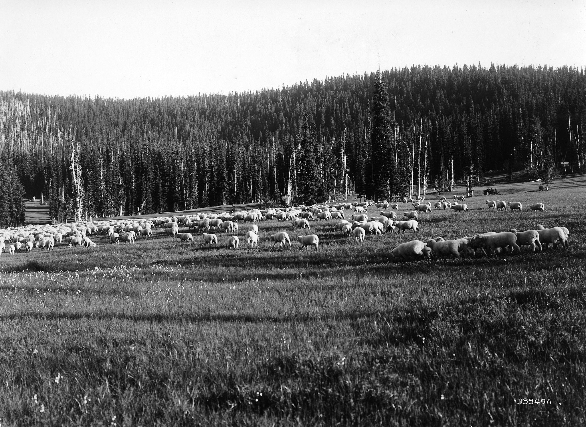
Shaniko, a town in the northern part of Central Oregon, was the “Wool Capital of the World.” Laborers transported the wool in wool wagons to mills in Waterloo, Jefferson, and Brownsville. Thousands of sheep traveled over the Santiam Wagon Road. In 1900, the Columbia Southern Railroad expanded its rail lines to Shaniko and wool wagons no longer needed to travel the Wagon Road. Unfortunately, a more heavily traveled rail line, built in 1911, bypassed Shaniko. It became a ghost town.


Oregon’s population grew from 13,294 in 1852, to 415,536 people by 1900. The population increased dramatically in the small towns of John Day and Canyon City during the gold rush of 1862. Kam Wah Chung & Co. was one of many businesses catering to mine workers around John Day. In these towns, the wagon road provided supplies for gold miners.


Travel on the road
It wasn’t easy to travel on the Santiam Wagon Road. Snow and rainfall could shut down sections for months at a time. We noticed where travelers created makeshift cobblestone by laying random pieces of native stones along the road.

There was a 2,600-foot climb in elevation to reach Tombstone Pass. Horses and oxen had to be unhitched from wagons in steep sections.
Parts of wagon roads passed through sections covered with lava rock. Water could be scarce and difficult to locate.

Once travelers reached the eastside of the mountains, they kept an eye out for Black Butte. It served as a sentinel and was a welcome sight to weary travelers.

First cars on the road
The first cars to travel the road were participants in the 1905 Hell Gate to Portland transcontinental race. This two-car race was part of the celebration for the Lewis and Clark Centennial Exposition. The cars, nicknamed Old Scout and Old Steady, drove west on the Santiam Wagon Road to reach Portland. It was a harrowing experience! The drivers had to carefully work their way around travelers and livestock using the road. The worst part was traveling downhill. The drivers tied trees to their cars to slow them down since the cars had poor braking systems. One car drove part way over a precipice. A prairie schooner ended up pulling them back from the edge.


The Santiam Wagon Road today
Parts of the Santiam Wagon Road became overgrown after Santiam Pass became the preferred route of travel in 1939. The ruts along sections of the road, and occasional blazes cut into trees, still mark the way.
Light Detection and Ranging (LiDAR) in recent years has made the route much more clear. This technology filters out vegetation and creates detailed 3-D maps showing the topography.

The trail we walked winds through Bureau of Land Management land and connects with the Deschutes Land Trust Whychus Canyon Preserve. The Land Trust has put a lot of time and effort into preserving this site. Signs along the route give helpful information about this historical road. There’s parking for about ten cars by an informational kiosk at the trailhead.

Here’s a map showing the preserve’s trails. We walked along the orange-red section of the trail.

Wow, what an amazing post on your local vistas! Beautiful and the history was great.
Thank you, Anne! Lots of interesting history close by. 🙂
I loved reading all the history of this route and surrounding area while enjoying your photos of the landscape and flowers! And the interior of Kam Wah Chung & Co looks amazing – is it preserved as a sort of museum or is it still a going concern?
Thanks, Sarah! Yes, Kam Wah Chung is open to the public – with a guide. They’re expanding the interpretive center. The building was locked up for decades and when they opened it, it was like a time capsule. Great place to visit!
Wow. Quite the historical journey! The ebb and flow of the frontier(s). Very interesting!
Glad you liked it, John! I didn’t realize how high the tolls to pass along that road were until I took that hike.
Wow Siobhan, what a great opportunity to showcase the history of your area. Honestly it’s amazing anyone EVER reached the west in light of the challenges. Great post, I really enjoyed the historic images as well as the trail as it is today. Amazing that LIDAR can teach us so much!
Thanks, Tina! I was saving that one for an appropriate challenge. 🙂 I can’t imagine traveling on some of those “roads” decades ago.